Hurricane Watch Net Reactivates as Hurricane Warning Posted for the Carolinas
With the National Hurricane Center (NHC) expecting Tropical Storm Isaias to become a hurricane again later today and make landfall this evening, the Hurricane Watch Net (HWN) reactivated at 1600 UTC on 14.325 MHz. HWN Manager Bobby Graves, KB5HAV, said the net will shift operations at 2300 UTC to 7.268 MHz, where it will remain until no longer needed by the NHC. A hurricane warning is in effect from the South Santee River in South Carolina to Surf City, North Carolina.
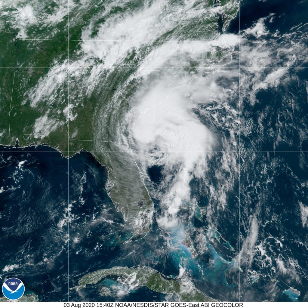
“The center of Isaias will then approach the coast of northeastern South Carolina and southern North Carolina within the hurricane warning area later today,” the NHC said. The center will then move inland over eastern North Carolina tonight, and move along the coast of the mid-Atlantic states on Tuesday and into the northeastern United States by Tuesday night.”
The HWN initially activated on July 31 at 1500 UTC, when Isaias was about 245 miles southeast of Nassau. “During the next 41 hours, we relayed the latest advisories to those in the Bahamas, south Florida, as well as mariners and shortwave listeners, Graves said. “Because Isaias was forecast to regain strength to a Category 1 hurricane, and hurricane watches and warnings remained in effect for the Florida coast as well as areas in the Bahamas, the Net remained activated.” After the NHC dropped all hurricane watches and warnings on Sunday morning, and the storm was no longer believed to become a hurricane, the HWN secured operations on Sunday, August 1.
“During the course of 41 hours, we never received any reports from the Bahamas,” Graves said. “We did hear from many south Florida stations, but the storm was not yet close enough at the time for [that area] to be adversely affected.
As of 1500 UTC, Isaias is forecast to make landfall tonight as a Category 1 hurricane and is expected to bring strong winds and heavy rainfall from the eastern Carolinas to the mid-Atlantic coast tonight and Tuesday. The storm was some 90 miles east-southeast of Brunswick, Georgia, and some 220 miles southwest of Myrtle Beach, South Carolina. Maximum sustained winds are 70 MPH, just a shade below Category 1 hurricane strength.
“We are slowly moving into the heart of the 2020 Atlantic Basin Hurricane Season, so, please do not drop your guard,” Graves advised. “If you haven’t done so already, now would be a good time to review your Family Emergency Plan and review your Emergency Supply Checklist. We have links to download both on our website.”
South Carolina Amateur Radio Volunteers Ready
Although Isaias hasn’t turned into a monster hurricane, radio amateurs from all over South Carolina have been preparing for days as the South Carolina Emergency Operations Center geared up for the storm. Isaias was predicted to make landfall on the border of North Carolina and South Carolina.
“We have been in direct communication with our emergency support function (EFS-2) partners along with many other organizations to ensure our level of readiness is sufficient. Radio checks have been performed at SCEMD (South Carolina Emergency Management Division) and more conference calls among ARES leadership are planned,” said ARRL South Carolina Section Emergency Coordinator Billy Irwin, K9OH. Irwin said information about frequencies in use may be found in the Tactical Guide on the South Carolina ARES website.
If you have found a spelling error, please, notify us by selecting that text and pressing Ctrl+Enter.


